

WATERPROOF CHARTS
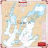
Waterproof Charts, Standard Navigation, 12 Northern Lake Champlain - Burlington to Richelieu, Easy-to-Read, Waterproof Paper, Tear Resistant, Printed on two sides, 2 charts in 1, NOAA ChartsRiver
£76.42
£127.37
-
 Order within to get between
-
 Tracked Shipping on All Orders
-
 14-Day Returns
- Secure Payments
-
 24/7 Customer Support
Description
- Starting at Willsboro and Shelburne Points coverage is north to and including Missisquoi Bay and the Rt 202 Bridge on the Richelieu River in Canada.
- Includes Malletts Bay and all of the Champlain Islands. When youre headed out on Lake Champlain, youll need this marine map.
- Cmon trust us! You wont find a more detailed nautical map than this. Or a more eye-catching one, you will want to frame this and hang it in your home or office.
- Starting at Willsboro Point and Shelburne Point coverage is north to and including Missisquoi Bay and the Route 202 Bridge on the Richelieu River in Canada.
- This navigation chart also includes Malletts Bay and all of the Champlain Islands.
Starting at Willsboro and Shelburne Points coverage is north to and including Missisquoi Bay and the Rt 202 Bridge on the Richelieu River in Canada. Includes Malletts Bay and all of the Champlain Islands. When youre headed out on Lake Champlain, youll need this marine map. Cmon trust us! You wont find a more detailed nautical map than this. Or a more eye-catching one, you will want to frame this and hang it in your home or office. Starting at Willsboro Point and Shelburne Point coverage is north to and including Missisquoi Bay and the Route 202 Bridge on the Richelieu River in Canada. This navigation chart also includes Malletts Bay and all of the Champlain Islands. This is a great complement to our southern Lake Champlain map #11. Information from 2 NOAA Charts 14782 and 14781. WGS84 / World Mercator Datum. 25" x 38" Easy-to-Read Large Print Waterproof Paper Tear resistant Paper (Indescribable) Printed on two sides - 2 charts in 1: Larger Area of Coverage Charts are Compiled From Several NOAA Charts & Local Information
Shipping and Returns
- We offer tracked shipping on all orders. Tracking information will be shared as soon as the order is dispatched.
- Please check the delivery estimate before adding a product to the cart. This is displayed for every product on the website.
- Available shipping methods and charges will be displayed at the time of checkout, depending on your exact location.
- All customers are entitled to a return window of 14 days, starting from the date of delivery of the product(s).
- Customers are advised to read our return policy for details of the return process, eligibility, refunds as well as cancellations or exchanges.
- In case of any issues or concerns about Shipping or Returns, please contact us and we will be happy to help.
Waterproof Charts.
Waterproof Charts, Standard Navigation, 12 Northern Lake ...
£76.42
£127.37